Segment the image according to the specified shapefile which contains geospatial vector data according to Esri and GIS standard.
Parameters
Shape file
Select shape file to use for the shape inference. The accepted file extension is: .shp in GIS format.
Point radius
If shape is a point, add some number of pixels as radius.
Link
Only visible when applicable
Link output objects from two or more segmentations to top segmentation. Descriptors can then be added to the common object output and will be calculated for objects from all segmentations.
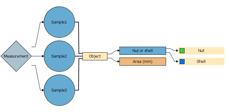
The segmentations must be at same level to be available for linking.