![]()
![]()
Depth interval registration lets the user create user-defined intervals based on the depth registered core from Depth registration (segmentation).
The depth registration(segmentation) needs to be set in Merge->”All lines in box” for the interval segmentation to work. See Merge option depth registration
The user defines the initial start position and length of segments. Intervals containing information from two recorded images will be segmented into two separate objects in the table and combined during export to csv. See xxx( create guide on how to export a finished core project)
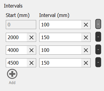
The interval ranges can be defined directly in the segmentation parameters or by importing a .csv file with the interval information. Intervals can be defined in the following units millimeter (mm), centimeter (cm), meter (m), inches(''), and feet(ft). See xxx on how to change units in your project. The .csv file needs to contain the following information
If only one start position and interval length are defined the same interval length will be used from the defined start position until the end depth of the depth registered core.
Parameters
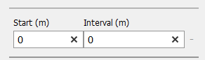
By default, the start position of the interval is zero with an interval length of zero based on the unit of your choice.
Example
Add and remove using the buttons: